In the context of Action B.5 “Upscaling project” we developed a Forest Information System (FIS) for an additional forest area in Tuscany: “Riserva Naturale Statale Biogenetica di Vallombrosa”. The experiences and results achieved during the activities in the other three demonstration sites were the base to develop the Vallombrosa FIS.
The FIS was develop to support the revision of Forest Management Plan in Vallombrosa and to give to the students of forestry courses of University of Florence the opportunity to use FIS during their field courses.
The area covered by Vallombrosa FIS is 1000 ha and the spatial data related to Forest Indicators were generated using UAV photogrammetric data acquired by eBEE and the LiDAR data acquired by aircraft in 2015 by Tuscany Region.


Field data acquisition


Remote sensing data acquisition by ebee UAV
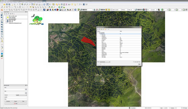
Screenshot by the Forest Information System on QGIS and, below, map of the growing stock for the Vallombrosa National Reserve