Here Below a 3D points cloud of Rincine Forest generated by images aquired by Drone (eBee) and Structure for Motion Photogrammetry Process.
For Tuscany, in collaboration with Unione dei Comuni Valdarno Valdisieve (UCVV) we work within the municipality of Rincine, this area is well known for its virtuous forest management that earned to it the admission within the International Forest Model Network (http://www.imfn.net/).
The area is characterized by mixed oak, beech and conifer plantations, ideal for depicting the forest ecosystems of the central Appennines, as you can see below in the map obtained by visual interpretation of the images acquired by the eBee drone.

Here below some sample images from the LIDAR data acquired by our drone in Rincine.


First maps of Sustainable Forest Management Indicators for the demonstration area of Rincine produced within our project.
- Maps of density of defoliated trees within each forest management unit. Threshold values were determined according to quantiles.

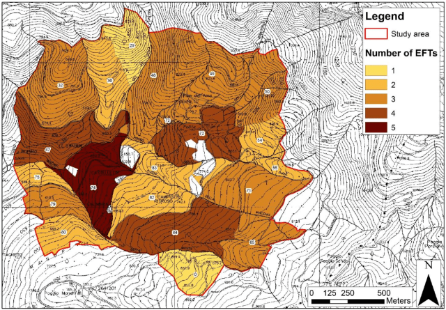
- Maps of “number of tree species” expressed in term of number of EFTs within each forest management unit.
- Map of “introduced tree species”