Here Below a 3D points cloud of Bosco Pennataro, our demonstration area in Molise, generated by images aquired by Drone (eBee) and Structure for Motion Photogrammetry Process.
In Molise, along with the Molise Region, we selected the area of Colle Meluccio – Montedimezzo, dominated by beech forests where the University of Molise has several research activities in progress related to old growth forests characterization and biodiversity monitoring.
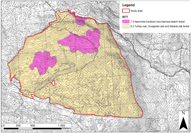
Here below the map obtained by visual interpretation of the images acquired by the eBee drone.
Some sample images from the LIDAR data acquired by our drone in Bosco Pennataro.


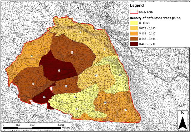
First maps of Sustainable Forest Management Indicators for the demonstration area of Bosco Pennataro produced within our project.
- Maps of density of defoliated trees within each forest management unit. Threshold values were determined according to quantiles.
- Maps of “number of tree species” expressed in term of number of EFTs within each forest management unit.